Fig. 1
Download original image
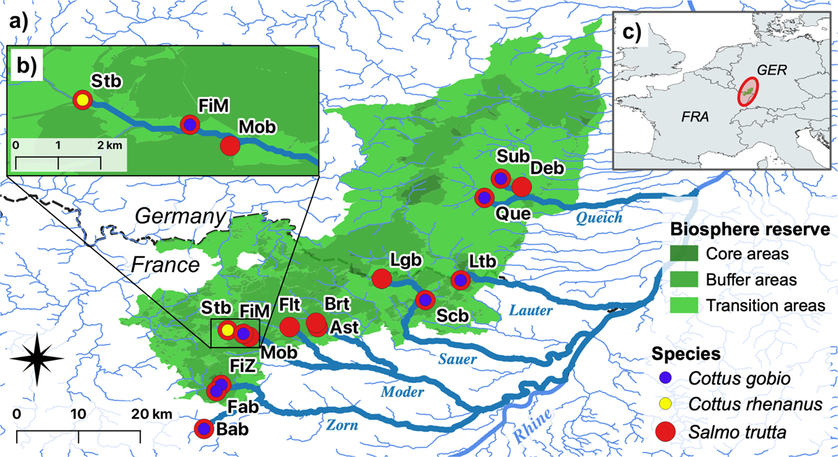
Location of the study waters in the Palatinate Forest-North Vosges Biosphere Reserve at the French-German border (a). Green areas indicate the different zones of the reserve. Circles mark the studied streams and their colors show the taxa found. Population codes are given in Table 1. The shortest distances between all study sites are highlighted in the river network by thicker, dark blue lines. Catchments are given by the respective stream names (cp. Tab. 1). River Rhine is indicated by a thicker line. The dashed line marks the border between France and Germany. For better visibility and scale, the area with sites Stb, FiM and Mob in the Moder catchment is enlarged in b). The location of the biosphere reserve in the border area between north-west France and south-west Germany in central Europe is shown in c).
Current usage metrics show cumulative count of Article Views (full-text article views including HTML views, PDF and ePub downloads, according to the available data) and Abstracts Views on Vision4Press platform.
Data correspond to usage on the plateform after 2015. The current usage metrics is available 48-96 hours after online publication and is updated daily on week days.
Initial download of the metrics may take a while.