Fig. 1
Download original image
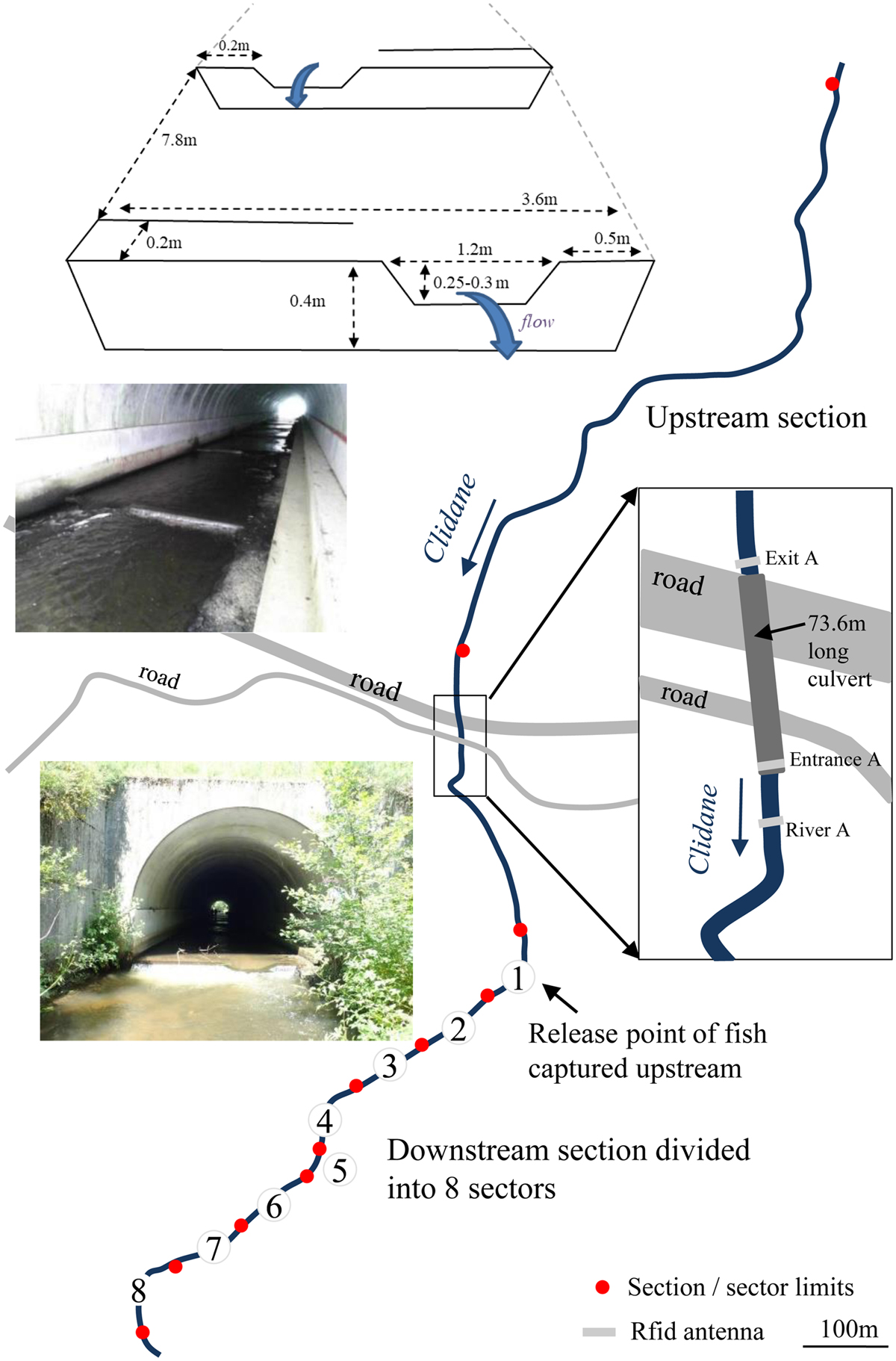
Study site on the Clidane River. The fished zones (upstream and downstream of the culvert) are delimited by the red dots. The dimensions of the baffles are given at the top. The two photos show the inside view of the culvert from downstream and its downstream entrance. The locations of the 3 PIT-detection flatbed antennas (River A, Entrance A and Exit A) are given in the right-hand box.
Current usage metrics show cumulative count of Article Views (full-text article views including HTML views, PDF and ePub downloads, according to the available data) and Abstracts Views on Vision4Press platform.
Data correspond to usage on the plateform after 2015. The current usage metrics is available 48-96 hours after online publication and is updated daily on week days.
Initial download of the metrics may take a while.