Fig. 1
Download original image
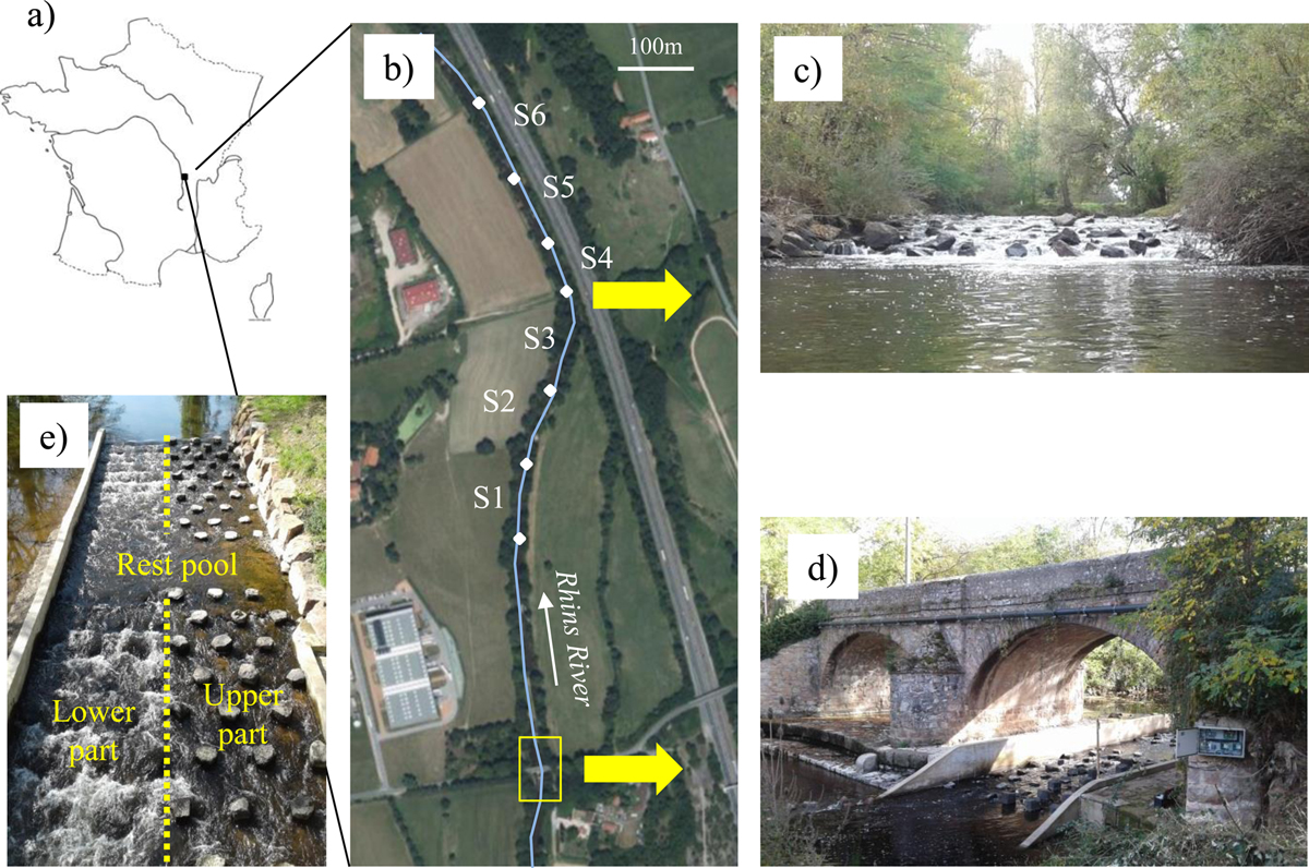
(a) and (b) Location of the study site on the Rhins River with indications of the fished river sectors (S1–S6), (c) rock weir located between S3 and S4, (d) bridge stabilization weir with macroroughness block ramp (view from downstream), (e) top view of two upstream ramp sections separated by a rest pool, showing two different bed levels on either side of the ramp.
Current usage metrics show cumulative count of Article Views (full-text article views including HTML views, PDF and ePub downloads, according to the available data) and Abstracts Views on Vision4Press platform.
Data correspond to usage on the plateform after 2015. The current usage metrics is available 48-96 hours after online publication and is updated daily on week days.
Initial download of the metrics may take a while.