Fig. 4

Download original image
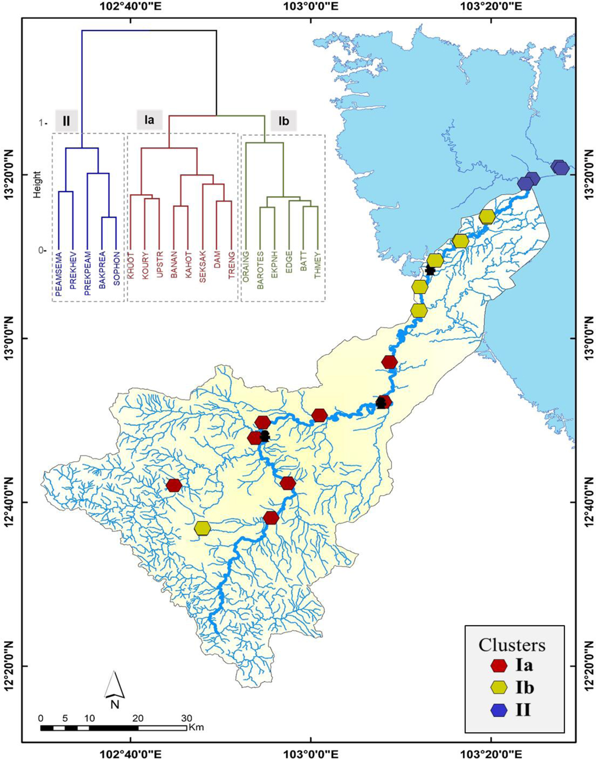
Spatial distribution of the benthic diatom community along the Sangker River catchment (Tonle Sap Basin). Hierarchical clustering (cluster dendrogram) according to the similarity of diatom genera composition (top left). Polygonal dots represent the diatom monitoring sites associated with the identified cluster (Ia & Ib, II). Different colors indicated benthic diatom community assemblages: red (Ia), yellow (Ib), and blue (II), while the black dot represented the dams.
Current usage metrics show cumulative count of Article Views (full-text article views including HTML views, PDF and ePub downloads, according to the available data) and Abstracts Views on Vision4Press platform.
Data correspond to usage on the plateform after 2015. The current usage metrics is available 48-96 hours after online publication and is updated daily on week days.
Initial download of the metrics may take a while.


