Fig. 1
Download original image
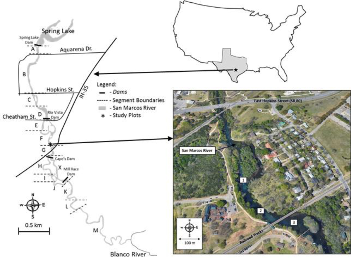
Map of the San Marcos River (left) depicting dams, river segments, and study plots in relation to Texas and the United States (upper right). Location of study plots where hydrilla was removed in different percentages and planted with water stargrass and Texas wild rice (bottom right). Research site 1 (29° 52’ 53.21” N, 97 56’ 04.40” W) and 2 (29° 52’ 49.67” N, 97 56’ 01.73” W) were in river segment C and site 3 (29° 52′ 48.98′ N, 97 55′ 59.03′ W) was located in river segment D. Segments represent boundaries established by the Texas Parks and Wildlife Department based on permanent boundaries (roads, dams, and tributaries).
Current usage metrics show cumulative count of Article Views (full-text article views including HTML views, PDF and ePub downloads, according to the available data) and Abstracts Views on Vision4Press platform.
Data correspond to usage on the plateform after 2015. The current usage metrics is available 48-96 hours after online publication and is updated daily on week days.
Initial download of the metrics may take a while.