Fig. 1
Download original image
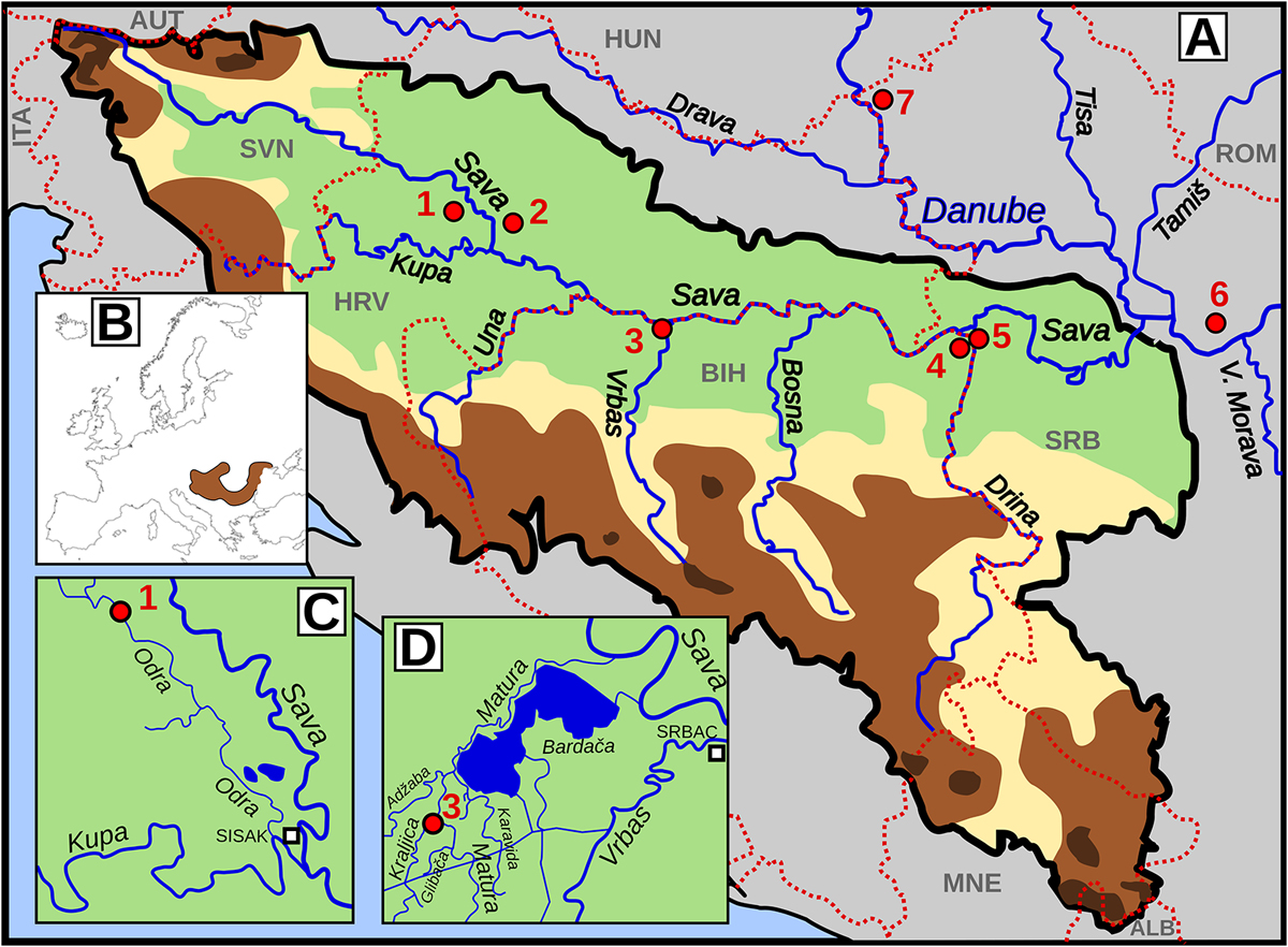
(A) Map of sampling locations (Odra-1, Šuma Žutica-2, Kraljica-3, Gromiželj-4, Bakreni Batar-5, Kraljevac-6, Lugomir-7). The Sava River system is delineated with a thick, black solid line, while the borders between countries are shown with thin, red dotted lines. (B) Distribution of Umbra krameri in Europe according to Wanzenböck (2004). (C) Detailed map of the lower Kupa River system. (D) Detailed map of the lower Matura River system.
Current usage metrics show cumulative count of Article Views (full-text article views including HTML views, PDF and ePub downloads, according to the available data) and Abstracts Views on Vision4Press platform.
Data correspond to usage on the plateform after 2015. The current usage metrics is available 48-96 hours after online publication and is updated daily on week days.
Initial download of the metrics may take a while.