Fig. 8
Download original image
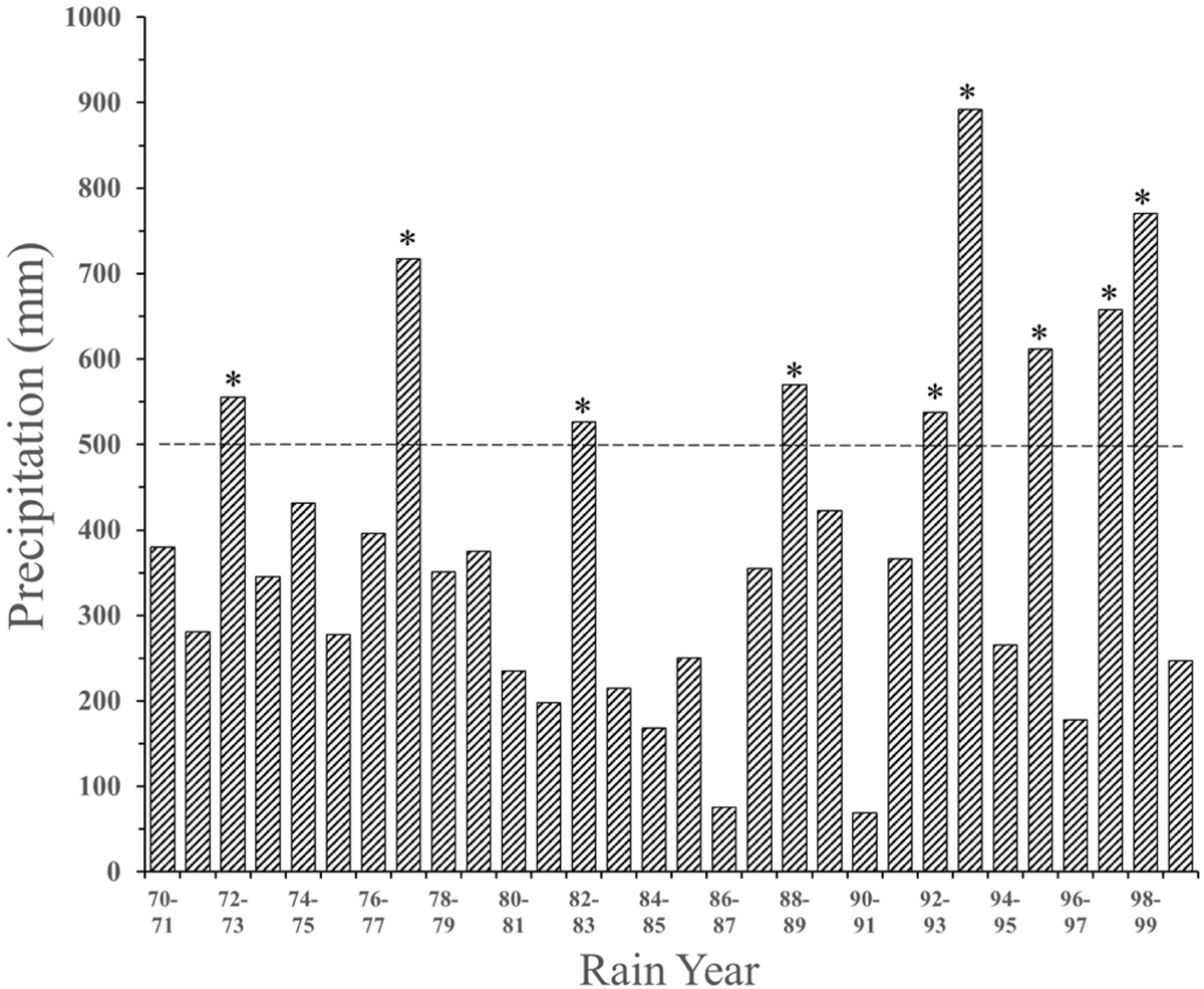
Annual precipitation (July–June) from 1970 to 1999 near Gorman Pond in the Tehachapi Mountains, Los Angeles County, California, USA. To determine the historical rainfall patterns before 2000, I used two weather stations: the Lebec station (about 8 km straight-line distance northwest of the pond) and Sandberg (about 8.5 km southeast of the pond), each of which had missing data for some years during the period of most rain (November–March). Between the two stations, however, I had complete or almost complete precipitation totals in these years. The dashed line is at 500 mm of precipitation, indicating high rainfall years (asterisks; see the Discussion section).
Current usage metrics show cumulative count of Article Views (full-text article views including HTML views, PDF and ePub downloads, according to the available data) and Abstracts Views on Vision4Press platform.
Data correspond to usage on the plateform after 2015. The current usage metrics is available 48-96 hours after online publication and is updated daily on week days.
Initial download of the metrics may take a while.