Fig. 1
Download original image
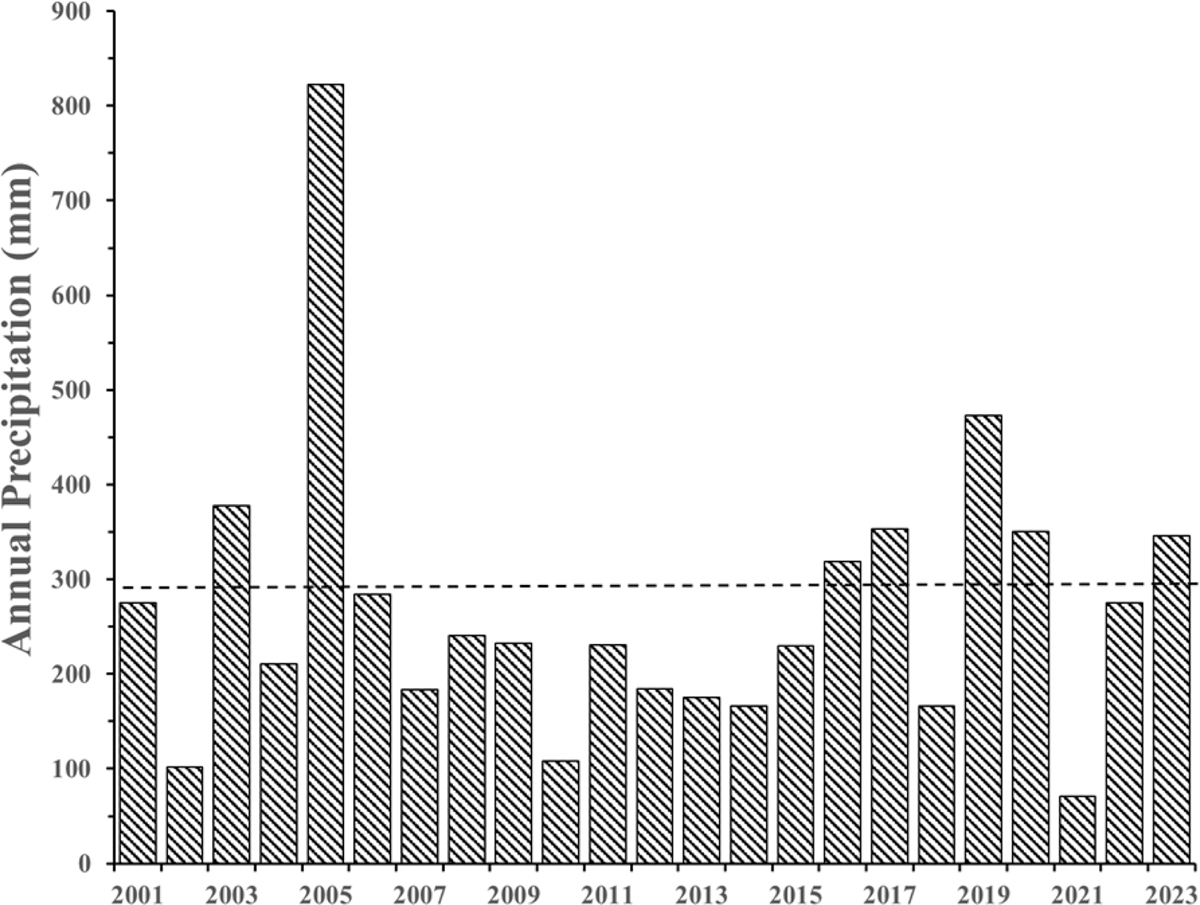
Annual precipitation (July–June) through 2018–2019 at the closest weather station (Lebec, about 8 km straight-line distance northwest) to Gorman Pond in the Tehachapi Mountains, Los Angeles County, California, USA (https://www.weather.gov/wrh/Climate?wfo=hnx). Because the Lebec weather station ceased reporting data after 2019, rain data for 2019–2021 through 2022–2023 are from the Sandberg station, 8.5 km southeast of the pond. Year shown are the end years (e.g., 2000–2001 is shown as 2001). The dashed line is the 30-year long-term average from 1970 to 1999, excluding those rain years that had missing data during the peak rain period (October–March).
Current usage metrics show cumulative count of Article Views (full-text article views including HTML views, PDF and ePub downloads, according to the available data) and Abstracts Views on Vision4Press platform.
Data correspond to usage on the plateform after 2015. The current usage metrics is available 48-96 hours after online publication and is updated daily on week days.
Initial download of the metrics may take a while.