Fig. 1
Download original image
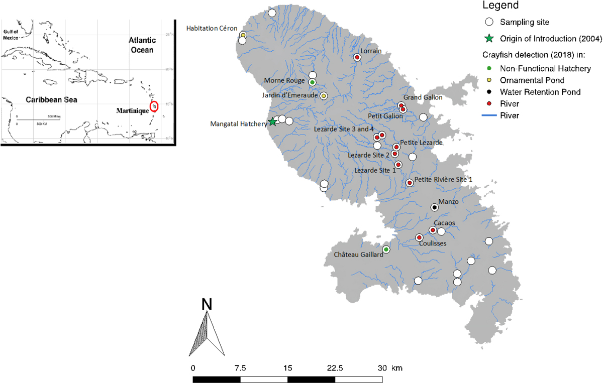
Cartography of the sampling sites of Cherax quadricarinatus together with the presence sites of this species in Martinique Island during 2018 field campaign. Sampling was carried out on permanent streams and in closed water bodies. Cartography was prepared using QGIS 2.18 (Las Palmas) software (QGIS Development Team 2016). The shape of Martinique Island was imported from the database IGN and the streams were found in BD Carthage and BD Topo.
Current usage metrics show cumulative count of Article Views (full-text article views including HTML views, PDF and ePub downloads, according to the available data) and Abstracts Views on Vision4Press platform.
Data correspond to usage on the plateform after 2015. The current usage metrics is available 48-96 hours after online publication and is updated daily on week days.
Initial download of the metrics may take a while.